A few months ago I mentioned that the UK Hydrographic Office was releasing survey data for many areas which contained much more detailed information than the standard charts from Navionics, etc. When I checked back on their website recently I noticed that a full survey is now available for Loch Etive, mainly using a 2m x 2m grid.
I downloaded all the data and ran it through Reefmaster to generate a full set of AT5 Etive charts for my Lowrance chartplotter, plus a set of images that might be of interest to anyone fishing Etive. The shallower areas are charted with a 25cm contour, whilst deeper areas have a 1m contour spacing – so there is a lot of detail in there.
To cover both my ass and yours I need to make it clear that these files are not intended to be used for navigation, but to help you identify marks to fish and get a better understanding of the loch. There isn’t really very much to hit in Etive, but don’t blame me if you do!
If you just want to look at an enlarged version of the images below then click on these to download the larger version. These are quite large (6-14 MB each) so may take a little while. Then just open in Photo Viewer or something similar and zoom in to the areas of interest to you.
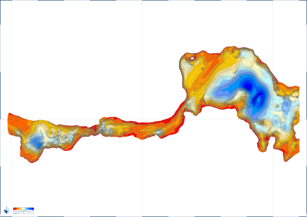


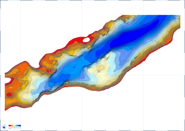
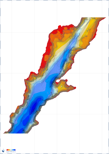

The main problem with the images is that is difficult to relate them to a specific feature or place in Etive. However, if you are a Google Earth user you can download the KML files below and save them in the same folder as the image file (i.e. download the image file(s) first, before the equivalent KML file). Then simply double click on the KML file to open Google Earth and load the image file alongside the Google imagery. The files may take a few minutes to load properly, so best to go get a coffee at this point.
Entrance to Loch Etive
Abbots Isles to Ardchattan
Airds Point to Bonawe
Bonawe to Cadderlie
Cadderlie to Kinglass
Upper Loch Etive
I haven’t uploaded the Lowrance AT5 files yet because (a) I haven’t checked them out myself and (b) they’re created for my older Lowrance chartplotter rather than the newer versions and (c) I need to sort out instructions for using multiple AT5 files on one card. Everything should work OK on newer kit than mine but with fewer features, and I’ll probably pop the files up at a future date.
A little update…
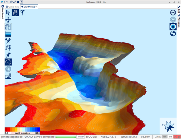
I’ve added a few more images, most of the area from Bonawe Narrows looking NE up Loch Etive, which show the some of the same information with a 3D view. They are scaled down from the full sized images, but might still take a few seconds to load.
The underwater cliffs on the right hand side of the image are roughly where the fish farm is (a popular mark which throws up quite a range of fish), opposite the main quarry.
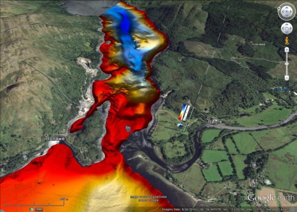
This next one is an export view from Reefmaster of the same chart. The KML file to use with Google Earth is here.
And this shows the results after embedding the previous file in Google Earth using the KML file – it makes it much easier to locate yourself within the charts (and you can zoom, etc. as you would normally in Google Earth).
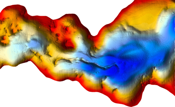
And a final image of quite an interesting little feature near Ardchattan, which looks like an old esker ridge left over from the ice age. I don’t know whether any of this really helps catch any more fish, but it does boost confidence a bit, and feeds my general fascination with maps and charts!
Share this: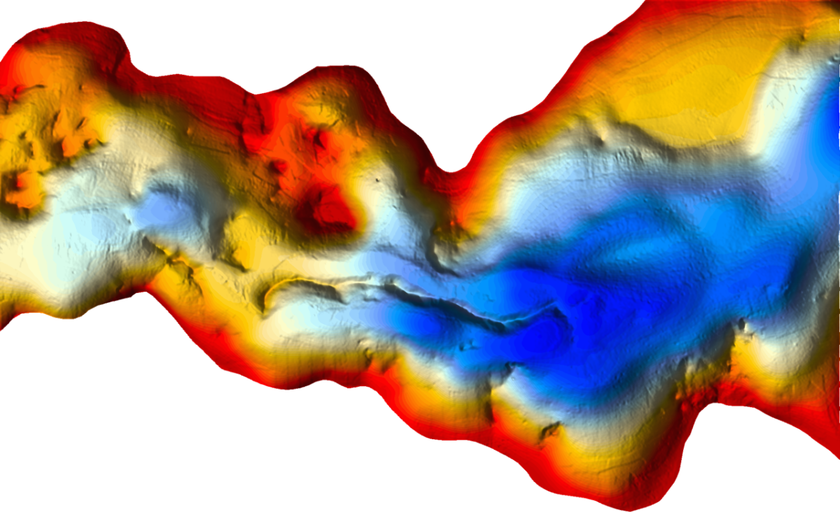

Thanks for uploading the survey data Doug!
I have just followed your instructions and it all worked a treat in Google Earth.
I’m going to be fishing Etive for the first time in my 165 in the next month and think this should help me out a good bit as my fishing skills could be classed as “all the gear but no idea ;-)”
Keep up the good work mate, your site is an inspiration to us novices….
Cheers
Neil
Hi Neil – glad you found it useful, and I’ve just added a small number of 3D images to the original post, as this helps visualise some features a bit better. To be honest I’ve caught fish in pretty much every location I’ve ever tried on Etive – the trick is just to be there at the same time they are! Be prepared to move about a bit if nothing shows at your first choice of mark, and keep changing the bait.
Good luck!
Doug
Great work, much appreciated.
Hi Doug, my son and I watch all your Youtube videos to follow your journey! Because of you and your adventures, we have booked a boat for the weekend in October and plan to find a nice spot to camp in the northern part of the loch. Could you maybe best place to camp where it’s relatively easy to get us and an Orkney ashore for the night? All the best, Bill
Hi Bill,
Obviously you’re very dependent on the weather, as you wouldn’t want to try this in anything other than light winds – and Etive can be horrible at times. That said, almost everywhere I camp with a hardboat is within 1 mile of Rubha Barr. There are beaches on both sides of the loch around here, with quite a few spots to put up a tent. Be aware that the beaches do have large boulders in them, so I don’t recommend letting the boat dry out unless you can keep a good eye on it – I always moor just offshore. I usually decide my spot depending on the forecast – Rubha Barr is very exposed to a SW wind but pretty sheltered from any northerlies, for example. There are other places you can moor and camp (e.g. the north side of Aird Trilleachan in a SW wind) but the Barrs area has some good options. I’d advise taking firewood in with you if you want a beach campfire, as fuel can be both scarce and wet, particularly on the east bank.
If you look at the post on Etive that I’ve just put up, you’ll see quite a few shots of the beaches I’m talking about. On this occasion I was camping on the east bank, about 1km south of Inverghiusachan Point, but there are also photos of potential sites on the west bank.
Cheers,
Doug
Is there an image with the whole loch?
Hi Lara,
Sorry – the individual images are all I have. Unfortunately I don’t have Reefmaster installed on my new PC so I can’t run a new export either.
Cheers, Doug