My earlier post on creating personal charts using UKHO data highlighted the amount of freely available, detailed, survey information available.

I’ve now updated and renamed my old DrDepth page to include a more detailed “how to” guide to using ReefMaster software to create personalised charts for use in Lowrance and similar kit.

The topic may seem a little technical but there is some very useful information out there without working up too much of a sweat (just browsing the UKHO imagery will show features that do not stand out on Navionics or C-Map charts).
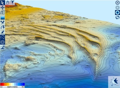
A series of large sandbanks show clearly in Reefmaster, but are unrecognisable in many other electronic charts
Share this:
Facebooktwitterredditpinterest

Charting Scotland

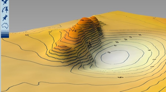
3D image of one of the peaks off Dunbar, generated by Reefmaster using UKHO survey data

Anyone fishing the areas around Mull and the sea lochs such as Etive, Sunart and Linnhe will be aware of the limitations of both the paper and electronic charts for the area, as most are based on very limited and old survey data. Widely spaced soundings can make it difficult to visualise the landscape underwater,… Continue reading Charting Scotland

11th September 2009 – Dunbar

Weather:Light NW wind, dry and largely sunny – clouding over later Sea Conditions: Calm Time Spent: 10:30 – 17:30 – 7 hours Tides: 11:58 GMT 1.6m Another disappointing day, although slightly better than yesterday. Spent a fair while on the River Garry but fish were just trickling aboard, so I headed over to the Redfish… Continue reading 11th September 2009 – Dunbar